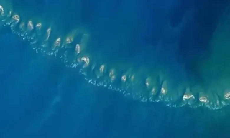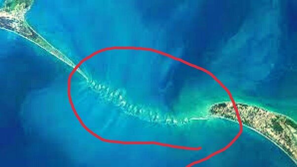
The Indian Space Research Organisation (ISRO) has successfully mapped Adam’s Bridge, also known as Ram Setu, an ancient submerged structure connecting India and Sri Lanka referenced in Indian religious texts. By utilizing data from ICESat-2 collected between October 2018 and October 2023, researchers created a detailed 10-meter-resolution map of the entire length of the submerged ridge, uncovering Ram Setu secrets. This resolution is precise enough to reveal details as small as the size of a train coach.
Scientific Insights from ISRO’s Study on Ram Setu Secrets
The comprehensive underwater map shows the continuous stretch of the bridge from Dhanushkodi to Talaimannar, with an impressive 99.98 percent of it lying submerged in shallow waters.
Role of Narrow Channels: Protecting Ram Setu from Sea Waves
In a study featured in the journal Scientific Reports, ISRO scientists employed advanced laser technology from a US satellite to produce a high-resolution map of the submerged ridge’s entire length. Led by Giribabu Dandabathula, the research team identified 11 narrow channels that facilitate water flow between the Gulf of Mannar and Palk Strait, playing a vital role in shielding the structure from sea waves. This study confirms that Adam’s Bridge, or Ram Setu, once served as a land link between India and Sri Lanka, offering fresh insights into the region’s history and the formation of this ancient structure.

The submerged structure, referred to as Adam’s Bridge by an East India Company cartographer, is known to Indians as Ram Setu. According to the Ramayana, this bridge was built by Lord Ram’s army to help him reach Ravana’s kingdom in Sri Lanka to rescue his wife Sita.
Ninth-century Persian navigators called the bridge Sethu Bandhai, meaning a bridge over the sea. Historical records from Rameswaram temples indicate that the bridge remained above sea level until 1480, when a severe storm caused its collapse.
Previous satellite observations suggested the presence of an undersea structure, but these studies mainly concentrated on the bridge’s exposed segments. The sea in this region is exceptionally shallow, with depths ranging from one to ten meters, complicating navigation and ship-based mapping of the ridge.
You might also be interested in – ISRO Chief Warns: Asteroid impact real threat, We must prepare


